• Skip to main content
  • Skip to primary sidebar

Pedaling Soul

  • About me

Jan 20 2025

Three Days I Won’t Forget on California’s Lost Coast

Black Sands Beach at Shelter Cove on California’s Lost Coast
Black Sands Beach at Shelter Cove at golden hour.

I went bikepacking on the Lost Coast because I wanted to feel small again. Out here the King Range pitches straight into the Pacific, Highway 1 ducks inland, and what’s left is a crooked web of pavement and dirt where wind writes the rules. I packed 700×45 tires, a small stove, and more stubbornness than fitness—and it turned into one of my favorite rides.

Day 1 — Ferndale → King Range (≈ 38 mi / 4,300 ft)

I rolled out from the gingerbread storefronts of Ferndale with a bakery croissant in the frame bag and fog still braided through pastures. Mattole Road tilted up so fast my coffee fizzed. Past Capetown the road finally bared its teeth—narrow lanes, damp corners under redwoods, and that metallic smell of ocean pushing inland. When the grade eased, I could hear the surf before I saw it.

Dirt climb on Kings Peak Road through tall forest
Dirt ramps on Kings Peak Road inside the King Range

By afternoon I was on Kings Peak Road—dirt, honest grades, a steady drumbeat of switchbacks. I camped on a mossy shoulder above a creek, cooked ramen fortified with cheddar and crushed chips, and fell asleep to the canyon breathing surf up to the trees.

Day 2 — Shelter Cove & Black Sands (≈ 32 mi / 3,100 ft)

Dawn delivered gulls, a cold crosswind, and a jittery descent into Shelter Cove. I topped bottles at the market, warmed my hands behind the wall, then walked the edge of Black Sands Beach—a bruise-dark ribbon under knife-steep bluffs. The waves hit hard; this is a “look, don’t swim” beach. I watched pelicans stitch the horizon and let the noise reset my head.

Turquoise water and bluffs at Shelter Cove
Turquoise water, black cobbles, and a steady Pacific pulse at Shelter Cove

The climb out was all cadence and breath: sit, stand, repeat. I traded gummy bears and trail intel with two riders near a pullout; they warned me the ridge winds would bite later. They did. I tucked the tent behind a curve of firs and slept to the ocean’s long exhale.

Day 3 — Sinkyone Bluffs → Usal Ridge (≈ 41 mi / 4,900 ft)

South of Shelter Cove the road threaded the edges of Sinkyone Wilderness. It narrowed, heaved, and smelled like wet cedar. I stopped above Bear Harbor and let the view turn my heart rate down—green amphitheater, white water, black rock, and a breeze that tasted like salt and rain.

Bear Harbor cove backed by steep coastal hills
Bear Harbor inside Sinkyone

One last push brought me to Usal Ridge. The Pacific opened in widescreen, then the road tipped down toward the creek. Ferns brushed the bars, gravel pinged the downtube, and potholes appeared like punchlines. I kept it tidy—Usal Road can be ugly when wet—then rolled onto 101 with salt on my lips and that ahh of cell bars, espresso, and civilization.

View north from south side of Usal Creek along the Lost Coast
Looking north from Usal Creek—the coast is empty because it mostly is

Written by admin · Categorized: Bike Adventures

Sep 28 2024

Riding the Hood Loop: A Multi-Day Adventure Around Mount Hood

Cyclist riding forest road around Mount Hood, Oregon
Rolling along a forest road on the Hood Loop around Mount Hood.

Day 1: Starting in Government Camp

The morning fog hangs low on Mount Hood as I unload my bike at Government Camp. The air is crisp, scented with pine and wet earth. My tires hit the forest road, and immediately I feel the rhythm of the Hood Loop: climbs, descents, gravel crunching under every pedal stroke.

The first section follows Highway 26 briefly before turning onto forest roads that wind through alpine meadows. Sunlight filters through tall pines, and small streams cross under rustic bridges. By midday, I reach Government Camp Café for a quick refuel: a hot coffee and oatmeal to fuel the climbs ahead.

Forest trail on the north side of Mount Hood
North side forest roads provide shade and solitude on day one.

Afternoon brings a steady climb, the forest thinning to reveal distant volcanic peaks. I camp near Timberline Lodge Road, setting up beneath towering pines as dusk paints Mount Hood in oranges and purples.


Day 2: Ridge Lines and Remote Singletrack

Sunrise lights the ridge lines as I tackle the most technical section of the loop: singletrack winding through lava rock and dense forest. The tires slip in wet moss at points, but the payoff is in the views — endless ridges, waterfalls glimpsed through the trees, and the quiet hum of wildlife.

Midday, I pass through Oakridge, a small mountain town famous for its bike culture. At Oakridge Bike Shop, I top off water and chat with locals about trail conditions. Their tips save me hours of searching for the next connection northward.

Singletrack and ridge views near Oakridge, Oregon
Singletrack through lava rock and pines offers challenging but rewarding riding.

Camp that night is tucked in a small clearing, the stars vivid above the Cascades. The air is cooler here, and the scent of resin fills the campsite.


Day 3: Southern Descent and Lakeside Reflections

The third day is more gradual. Rolling hills give way to smooth forest roads, and I descend toward Clear Lake. The lake mirrors the sky perfectly, and I stop to soak my legs and refill bottles. Few people are around; the trail feels private, as though it exists solely for riders who make the effort to find it.

Clear Lake, Oregon, reflection on water
Clear Lake — a serene mid-ride stop for reflection and hydration.

Continuing east, I reconnect with forest roads leading back toward Mount Hood. The loop closes with a long descent back into Government Camp. My legs ache, but there is a sense of accomplishment. Three days, multiple ridges, thousands of feet of climbing, and the constant reward of Oregon’s wilderness.

Written by admin · Categorized: Bike Adventures

Apr 22 2024

Riding the Oregon Outback: A Journey Through Oregon’s High Desert

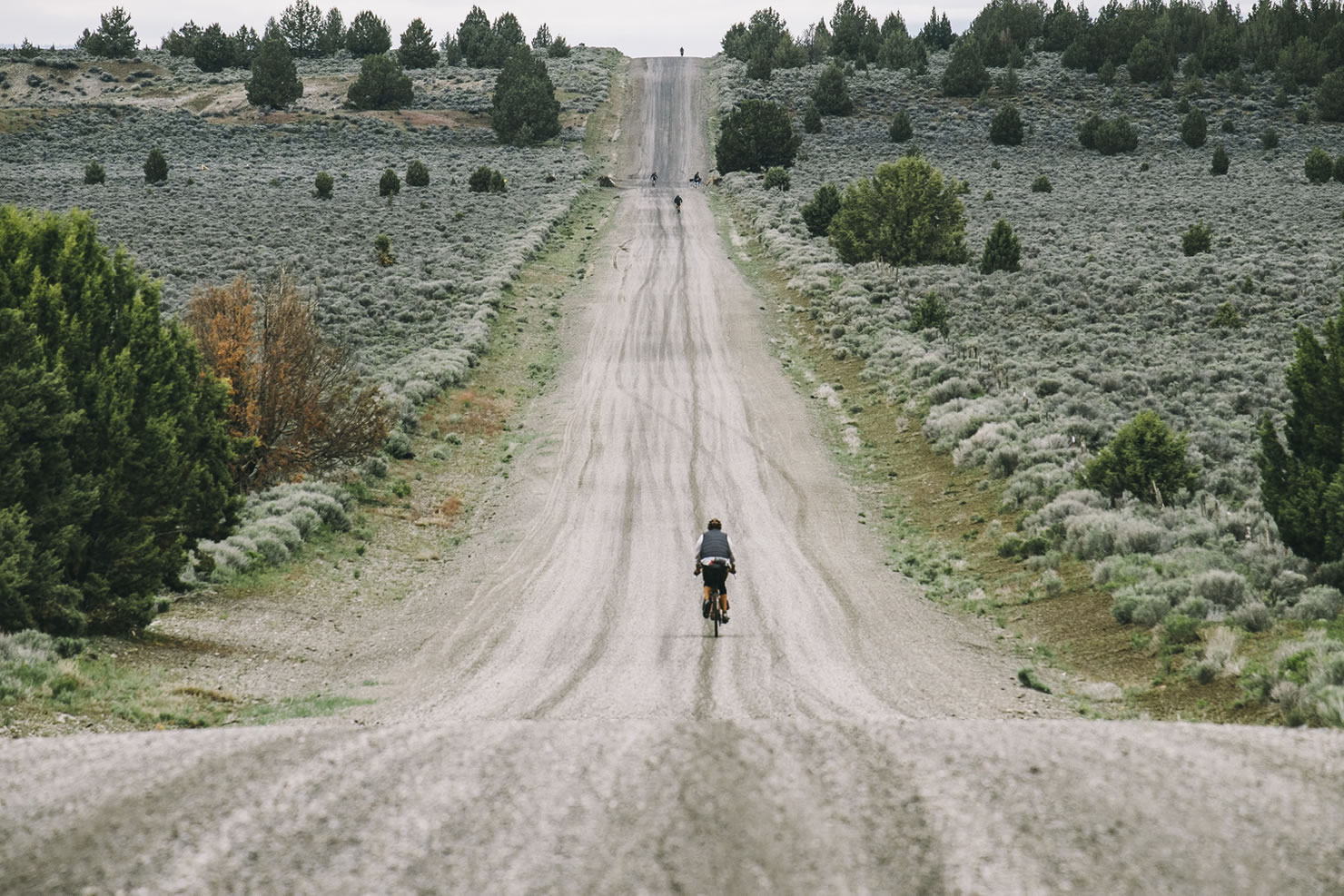
Bikepacker riding the Oregon Outback gravel road through sagebrush under big Oregon sky
Crossing the wide-open gravel roads of the Oregon Outback near Silver Lake.

Day 1: Rolling Out from Klamath Falls

The first light hits Upper Klamath Lake as I roll out of town, legs fresh and spirit high. The bike feels heavy, packed with food and gear, but the promise of the Oregon Outback stretches ahead — 360 miles of gravel, rail trail, and remote forest roads leading all the way to the Columbia River.

After leaving pavement, I follow the OC&E Woods Line State Trail, once a railway, now a corridor of dust and sage. My first stop is Henzel’s Grocery in Sprague River, a classic small-town store with an old Coke sign and a friendly hello from behind the counter.

Gravel rider on OC&E Trail near Klamath Falls, Oregon
Early miles on the OC&E Trail leaving Klamath Falls.

By evening, I camp near Beatty beneath a stand of pines. One truck passes, the sound fading quickly. The first night reminds me how vast Oregon really is.


Day 2: Through the Sage and Into Silver Lake

The next morning brings wind and wide horizons. Dust coats my shins as I ride through cattle country, a hawk tracing lazy circles overhead. Around noon, the road spills into Silver Lake, a one-street town that feels like a movie set. I stop at Silver Lake Café & Bar for a burger and conversation with ranchers swapping stories over black coffee.

Exterior of Silver Lake Café and Bar, Silver Lake Oregon
Lunch stop at Silver Lake Café & Bar — where burgers and gravel dust meet.

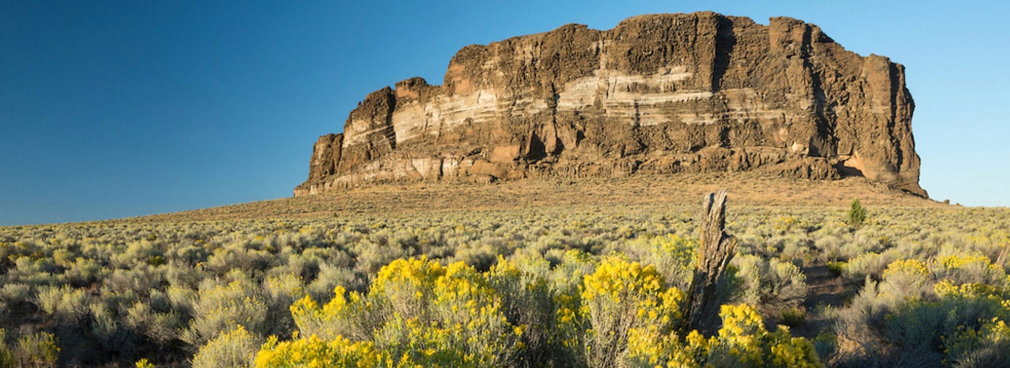
As the afternoon heat climbs, the landscape opens into shimmering desert. I refill my bottles at a cattle trough and push on toward Fort Rock, where volcanic cliffs rise from the plain. I camp in their shadow under a violet sunset.


Day 3: From Fort Rock to La Pine and Prineville

Morning brings a pink glow over Fort Rock. I ride north through pine forest until the route dips into La Pine. Civilization feels strange after so much silence. At Harvest Depot Café, the pancakes arrive stacked and steaming. Locals ask about the route and shake their heads when I tell them where I started.

Harvest Depot Café in La Pine Oregon
Breakfast fuel at Harvest Depot Café in La Pine.

The trail climbs again into forest, then drops into the Crooked River Grasslands. The light is sharp, the gravel smooth. I camp near the canyon rim and fall asleep under a sky crowded with stars.


Day 4: Wind and Color in Brothers

Day four feels like the essence of the Oregon Outback. Wind in my face, empty road ahead, and nothing around but sky. The landscape becomes more painted and surreal as I reach Brothers, Oregon — a tiny stop on Highway 20 where The Feed Barn serves coffee and conversation.

The Feed Barn café and store in Brothers Oregon
The Feed Barn in Brothers — part store, part café, full of character.

The owner warns me about afternoon winds. She’s right. The last twenty miles into Prineville Reservoir are a fight. I camp by the water, shoes off, sipping the beer I carried all afternoon.


Day 5: The Descent to the Columbia

My legs are sore but strong now. The road rises through wheat country and then plunges into the Deschutes River canyon. The Columbia River appears at last, wide and silver in the sunlight. When I reach Deschutes River State Recreation Area, I set the bike down and walk to the water’s edge. The ride is complete.

Cyclist arriving at the Columbia River at the end of the Oregon Outback route
Touching the Columbia River — the end of the Oregon Outback route.

There is no finish line. Just the quiet hum of the river and the satisfaction of having crossed an entire state by pedal power.

Written by admin · Categorized: Bike Adventures

Sep 11 2022

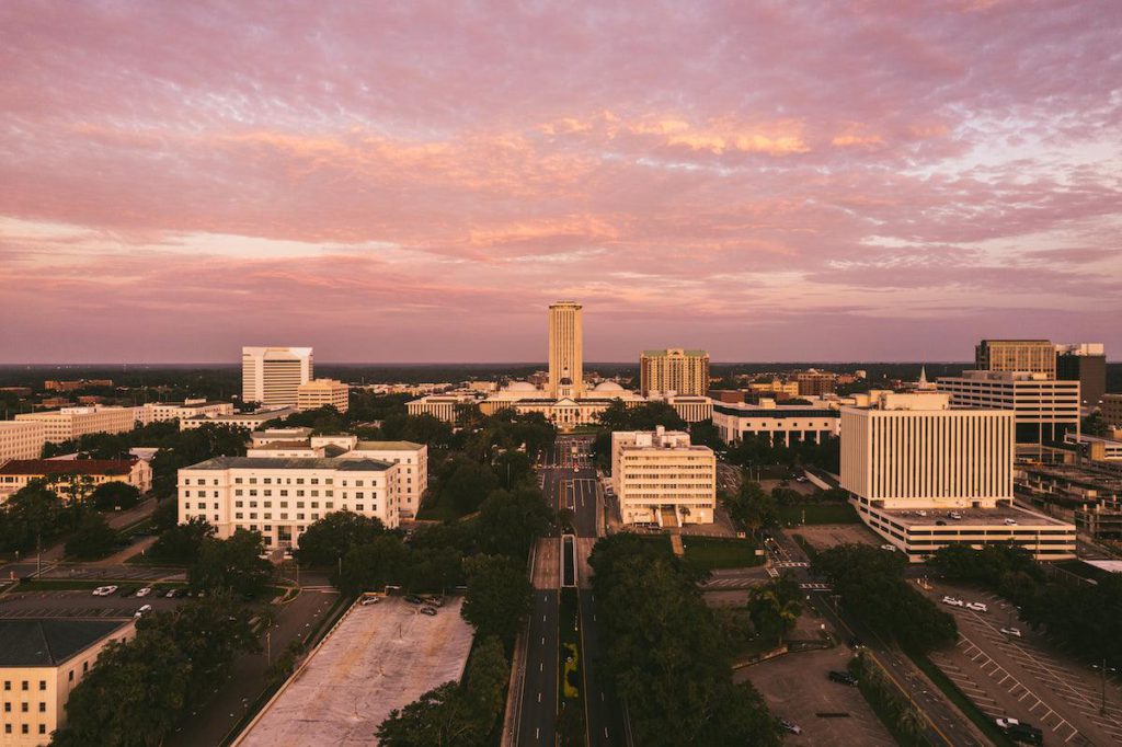
My adventures in Tallahassee Florida

The alarm went off at 4:15 in the morning. I was already awake, staring at the ceiling and wondering if this was a good idea. The air was still and thick, the kind that sticks to your skin before sunrise. Sandy pulled up in her old pickup just as the sky started to lighten, her bike rattling in the back. We didn’t say much, just loaded up bottles and checked tires. It felt like the start of something too big to talk about.

We rolled out from Lake Ella before the sun was up. The streets were empty, and the air carried that damp smell of summer grass. The first few miles felt easy. Our bikes hummed softly over the pavement, and every pedal stroke seemed to find its rhythm without effort. The sky turned from purple to gold as we headed south, and by the time we reached Crawfordville Road, the light was sharp and clear.

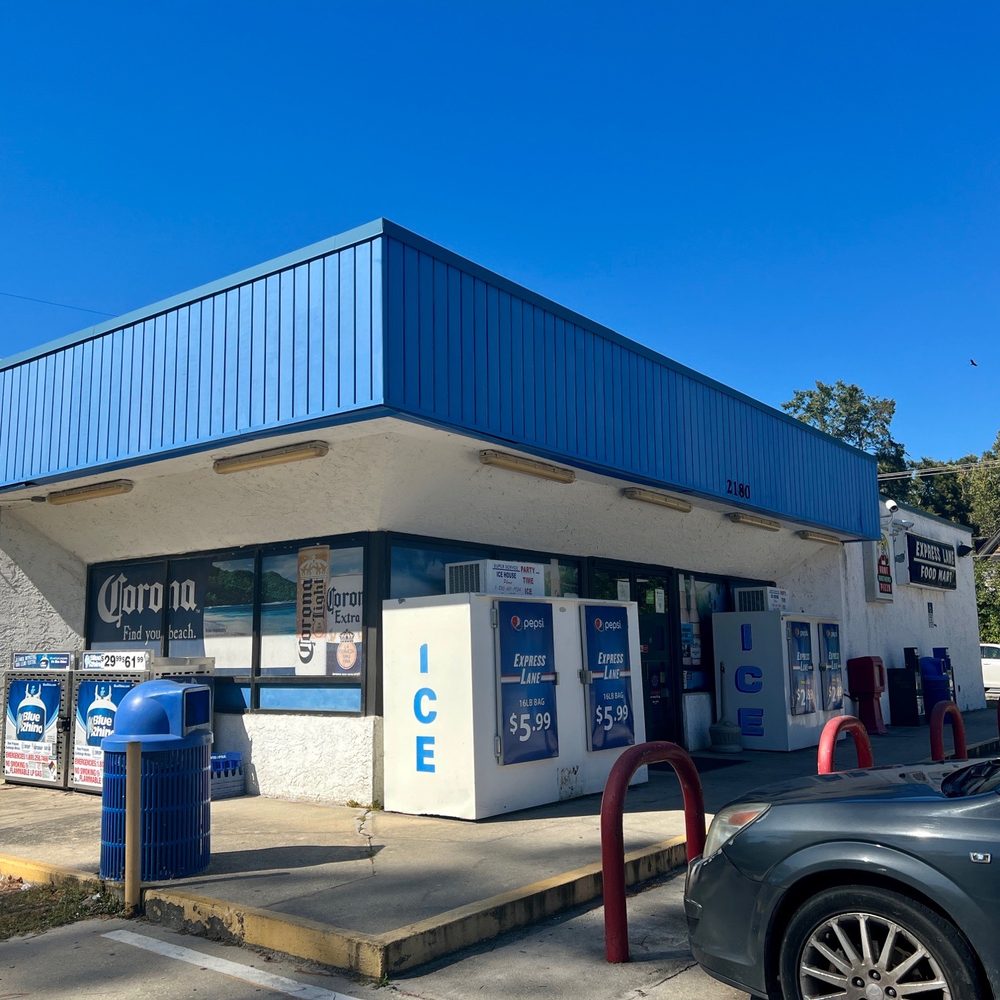
Our first stop came at a gas station near Sopchoppy. The man behind the counter had a weathered face and a quiet stare. He asked where we were headed, and when I told him we planned to ride two hundred twenty-two miles, he raised his eyebrows and handed me an extra bottle of water without a word. We sat outside on the curb, drinking and stretching, watching the small town start its morning.

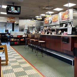
The road to Perry is long and straight. It gives you time to think. We didn’t talk much, just took turns leading. The heat came early, and by the time we reached the outskirts, it felt like riding inside a hair dryer. We stopped at a diner called HuddleHouse. The sign was fading, the door creaked, and the coffee came in chipped mugs. We ordered pancakes, bacon, and Cokes. The waitress asked if we were training for something, and Sandy said, “No, just living,” which made her laugh.

After Perry, the road opened into scrubland and pine. The smell of salt and dust hung in the air. Around mile one hundred twenty, something moved in the brush. Three wild boars burst out of the trees, thick and fast. Their hooves clattered across the road, one close enough for me to feel the rush of air as it passed. Sandy shouted, and we both stood on the pedals, hearts pounding. When they were gone, we stopped and just stared at each other. Then she grinned and said, “Well, that’s one for the story.”

By afternoon, the sun had turned mean. The light bounced off the asphalt, and the wind felt like an oven door opening. We found a small store in Aucilla where the owner sold cold Gatorade and fried chicken. We sat on the curb, eating slowly and not saying much. My legs were beginning to tremble when I stood up. The air buzzed with heat and insects.

The last stretch toward Monticello was quiet. The fields glowed in the evening light, and the sky turned the color of old copper. Cars passed occasionally, each one raising a wave of warm wind that pushed against our tired bodies. Somewhere around mile two hundred, we both fell silent. The sound of the tires was the only rhythm that mattered.

We reached Tallahassee just as the streetlights flickered on. The city looked soft, familiar, like it had been waiting for us. I unclipped from the pedals and nearly stumbled. My back ached, my face felt tight with salt, and my hands tingled. Sandy leaned her bike against the car and laughed. It was the kind of laugh that comes from somewhere deep, full of exhaustion and disbelief.

Two hundred twenty-two point six miles. One long, sun-soaked loop through the backroads of North Florida. We stood there in the quiet, our bikes dusted with road grit and sweat, the sky finally giving way to night.

Sandy looked at me, smiling through the tired. “You know,” she said, “we could have done two-fifty.”

I shook my head and laughed. Maybe next time.

Written by admin · Categorized: Bike Adventures

Jul 09 2022

Cross Florida: The Spanish

Setting Off

Start morning one at the shoreline of Fort DeSoto Park, on the Gulf side near St. Petersburg. The loaded bike feels heavy; you know you are committing to a long journey. After a quick photo at the beach, you roll north and then east out of the park, into the early light, anticipating singletrack, sand, paved connectors, forest roads, and more.

The first several miles are gentle pavement and bike path, allowing you to compartmentalize gear, check bags, adjust tire pressure, and settle into the rhythm. The route description for The Spanish reminds riders that it is a patchwork quilt of singletrack, forest roads, double track, grassy track, bike paths, and paved roads

Day 1: West Coast to Tarpon Springs

By midday you hit the trail system that leads toward Tarpon Springs, a charming coastal town with a Greek heritage.

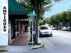
In Tarpon Springs you pause at the downtown shops: natural sponges, Greek imports, cafés. According to visitor info, the downtown is lined with specialty stores and boutiques. Visit Florida
Stop at one of the small markets or grocery stores to top off snacks, water, and maybe pick up some fresh fruit for late afternoon fuel. After the break you mount up and head inland. Evening finds you in a campground or dispersed spot at the forest edge, listening to crickets.

Day 2: Into the Interior & Remote Forest Roads

You wake to dew on the tent, maybe fog in the pines. The trail begins to leave the coastal suburbs behind and enters long stretches of forest roads and double track. Sand and root-covered paths require patience. One rider described this section of The Spanish as “loose and challenging to ride … pushed a big gear through the loose sand.” toonecycling.com


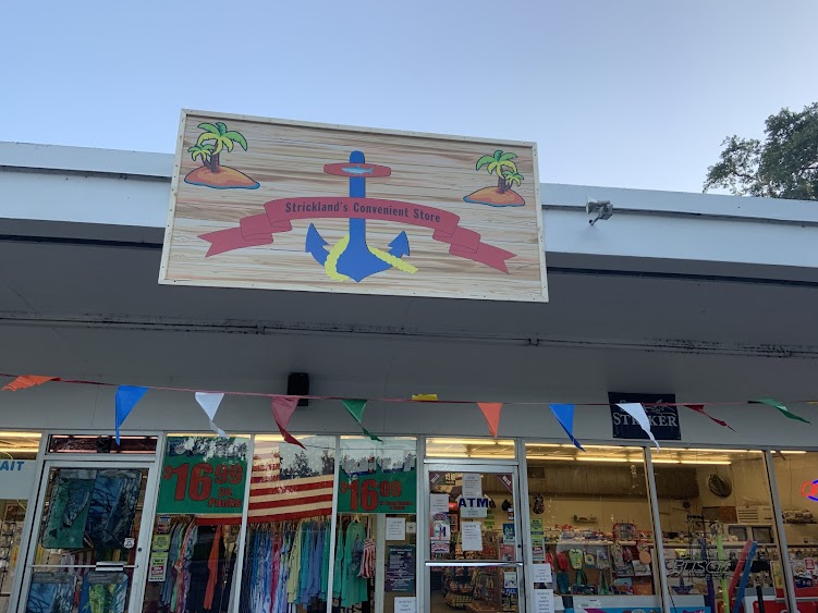
By mid-afternoon you pass through a small convenience store in the interior — let’s say somewhere near Homosassa Springs. For example, you stopped at Strickland’s Convenient Store, Homosassa: a quick refuel point (cold drink, chips, maybe a sandwich).


Day 3: Long Day, Reaching Civilization

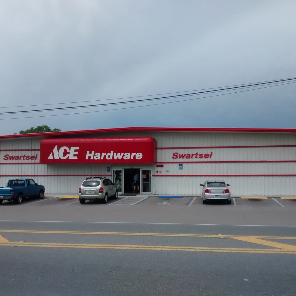
Today is a long day: you traverse more remote terrain, patches of sand, rooty singletrack, and some paved connectors. By late afternoon you approach yet another resupply point: in the town of Tarpon Springs earlier and now you reach something different. Let’s mark the stop at Ace Hardware – Homosassa (3600 S Suncoast Blvd, Homosassa). While not a food store it offers unexpected gear — you replaced a stripped bolt on your rack and picked up an extra bungee strap.

After the gear fix you have one more push into evening and camp near the state forest edge. The wildness deepens. You reflect on how Florida is deceptively demanding: elevation may be low, but sand and roots beat you up.


Day 4: The Home Stretch to the Atlantic

You rise early, break camp, pack lightly for the final stretch. Leg muscles are tired, but mind is focused on the finish. You cross into the eastern side of the state, track beside rivers, glades, and eventually urban fringe. You roll into St. Augustine near dusk and arrive at the historic location by the old fort, the Atlantic waves touching shore.

You lock the bike, walk to the water’s edge, feel the salt spray, and take the ceremonial finish photo. You’re exhausted, exhilarated, sunburned in patches, legs sore, but filled with satisfaction.

Written by admin · Categorized: Bike Adventures

  • « Go to Previous Page
  • Page 1
  • Page 2

Primary Sidebar

Recent Posts

  • Three Dusty Days on the Carrizo Plain
  • Three Windy, Perfect Days in the Columbia River Gorge
  • Three Dirt-Heavy Days in the Sierra Foothills
  • Three Islands, Three Days, Just Enough Time
  • Three Slow Days Beneath the Redwoods

Categories

  • Bike Adventures
  • Uncategorized

Copyright © 2025 · Altitude Pro on Genesis Framework · WordPress · Log in